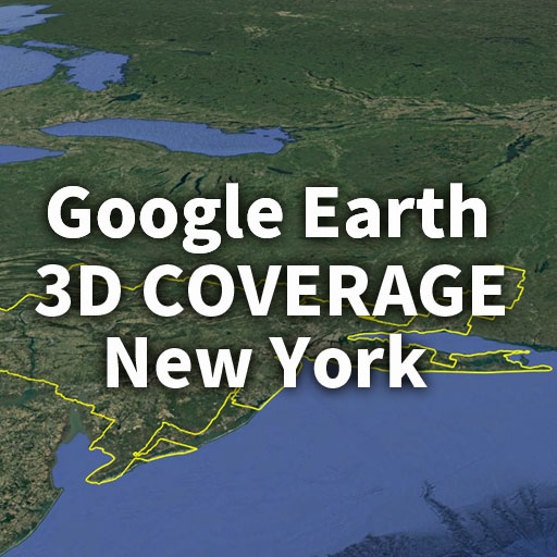
Googleアースの3D表示は、どこまで広がっているのでしょうか。
2017年、Google Earth Blogは、ニューヨーク周辺の3Dエリアを約19,500km²と紹介しました。これは当時としては世界最大級の規模であり、多くのユーザーにとって衝撃的なものでした。
本記事では、その先にある「現在」に注目します。
実際にGoogle Earth Proを用いて境界をトレースし、現在の3Dカバレッジを可視化・再検証しました。
さらに、本記事で使用したニューヨークの3D表示エリア境界データ(KMLファイル)を公開しています。Google Earthで読み込むことで、実際の範囲をそのまま体感できます。
How far has Google Earth’s 3D coverage expanded?
In 2017, Google Earth Blog reported that the 3D coverage around New York was approximately 19,500 km², making it one of the largest in the world at the time and a surprising milestone for many users.
In this article, we focus on the “present.”
Using Google Earth Pro, we traced the boundaries of the 3D imagery to visualize and re-examine the current coverage.
In addition, the KML file used in this analysis—independently traced for this article—is available for download.
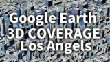
https://ejy-tours.com/earth-3d-coverage-map-los-angeles/
セクション①: New York 現在の3Dエリア
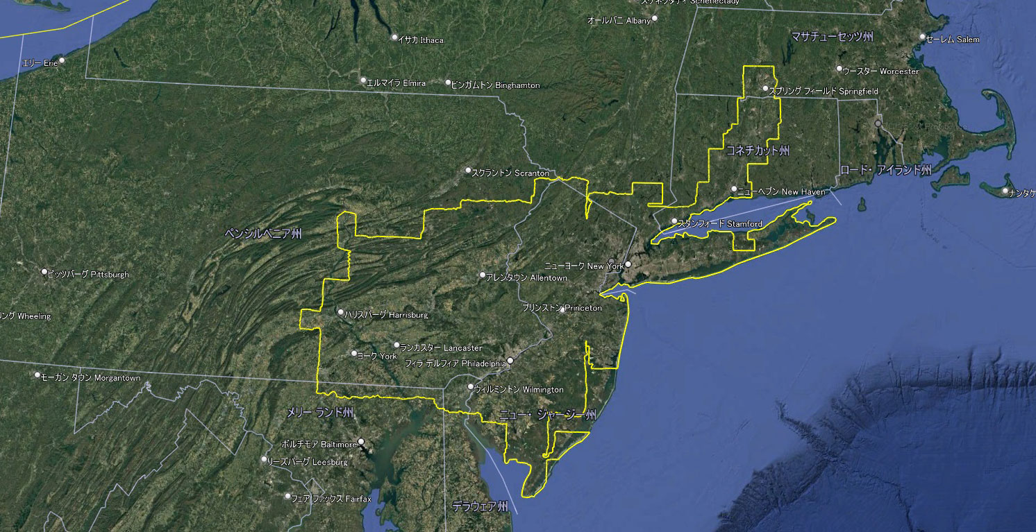
Google Earth 3D coverage around New York
今回、Google Earth Pro上で3D表示の境界を手作業でトレースした結果、ニューヨーク周辺の3Dエリアは外周約2,516kmに達しました。
その範囲は
- ニューヨークを中心に
- ニュージャージー州
- ペンシルベニア州
- コネチカット州
にまで広がり、従来の「都市単体」ではなく、広域都市圏全体を覆う構造となっています。
By manually tracing the 3D boundaries in Google Earth Pro, the total perimeter of the New York 3D coverage reaches approximately 2,516 km.The area now spans across multiple states, forming a large, continuous metropolitan-scale 3D region rather than isolated city blocks.
セクション②:2017年までの資料との比較
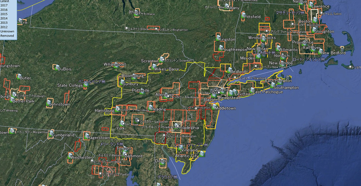
Google Earth New York: Past and Present 3D Coverage Comparison
黄色い線:現在
それ以外の線:Google Earth Blogによるデータ
2017年時点では、3Dエリアは都市ごとに分かれた「パッチ状」の構造でした。
しかし現在では、それらが連結され、一体化した巨大なエリアへと進化しています。 この変化から、表示の基準や整備方針が大きく転換されたことは明らかです。
過去のデータは、進化を続けるGoogle Earthの歩みを記録した、貴重なアーカイブと言えるでしょう。
Yellow line: Current coverage
Other lines: Data from Google Earth Blog
As of 2017, 3D coverage consisted of fragmented, patch-like areas divided by individual cities.However, today these areas have become connected, forming a single, large unified region.This transformation clearly indicates that the underlying standards and development strategy have significantly shifted.Past data can therefore be seen as a valuable archive, documenting the evolution of Google Earth over time.
New York (NY・NYC) 3D表示エリアの面積推定と規模分析
今回トレースした外周(約2,516km)から、3Dエリアの面積についても概算を試みました。
面積の算出にあたっては、まず外周から円形を仮定した理論値を導出し、その後、実際の地形に合わせた補正を加える方法を採用しています。なお、この計算過程の整理にはChatGPTも補助的に活用しました。
単純に円形と仮定した場合、理論上の面積は約50万km²規模となります。しかし実際の3Dエリアは複雑な形状をしており、内部に空白も含まれるため、この値は過大評価となります。
そこで都市圏に特有の形状を考慮した補正を行うと、ニューヨーク周辺の3D表示エリアは、
およそ12万〜22万km²程度と推定されます。
2017年時点で約19,500km²とされていたことを踏まえると、現在の3Dエリアは単純比較で数倍規模に拡大している可能性があります。
Based on the traced perimeter of approximately 2,516 km, an estimation of the total 3D coverage area was also conducted.
The calculation approach involved first deriving a theoretical value assuming a circular shape, followed by applying corrections to account for the actual irregular geometry. The structuring of this estimation process was assisted in part by ChatGPT.
Under a simple circular assumption, the area would reach approximately 500,000 km². However, due to the complex shape and internal gaps, this represents an overestimation.
After applying a correction factor suitable for metropolitan-scale regions, the actual 3D coverage around New York is estimated to be
between 120,000 and 220,000 km².
Compared to the approximately 19,500 km² reported in 2017, this suggests that the coverage has expanded several times over.
New York KMLデータ公開
本記事で使用した3D表示エリアの境界データ(KMLファイル)を公開しています。
Google Earthで読み込むことで、実際の範囲を確認できます。
The KML file used in this analysis is available for download.
Load it into Google Earth to explore the exact 3D coverage boundaries.

Google earth 3D area around NY
広がり続ける3D表示、その先へ
今回紹介したニューヨーク周辺の3D表示エリアに加え、ロサンゼルスやサンフランシスコといった巨大都市圏でも、同様に顕著な拡大が確認されています。
これらの詳細については、別記事にて改めて検証していきます。
さらに、日本の3D表示基準との違いやエリア比較についても、興味深い知見が得られています。
こちらも今後の記事で詳しくご紹介する予定です。
Google Earthの3D表示は、今後どこまで拡張していくのか――その変化を引き続き追っていきます。
Beyond the New York area covered in this article,major metropolitan regions such as Los Angeles and San Francisco have also experienced remarkable expansion in 3D coverage.
Their full extent will be analyzed in dedicated articles.
In addition, comparisons with Japan’s 3D mapping approach have revealed intriguing differences, which will be explored further in future posts.
The question remains: how far will Google Earth’s 3D coverage expand next?
コメント