Google Earth-based visual guides, 3D map explorations, and spatial analysis of global cities and regions.
 City Guides
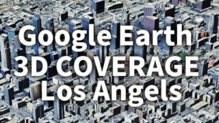
 Los Angeles 3D Coverage Map Fully Revealed | Google Earth 3D Buildings & Hidden Zones in LA
Los Angeles 3D coverage map visualizes where Google Earth’s 3D building and terrain data is available across LA. Explore detailed photorealistic urban zones, partial coverage areas, and non-3D regions in Google Earth’s evolving 3D map system.
 City Guides
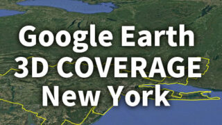
 Google Earth 3D New York: Full Coverage Map, Areas & Expansion Timeline
Explore how Google Earth’s 3D coverage in New York has evolved from fragmented city-based areas in 2017 to a seamless, unified region today. Discover what this transformation reveals about mapping technology.