For first-time visitors to Global Map Insights
When viewing a city in Google Earth, you may notice areas where buildings and terrain are rendered as photorealistic 3D models.
However, it is not always easy to identify exactly where the 3D coverage ends and the standard 2D imagery begins simply by exploring Google Earth.
At Global Map Insights, we independently examine the boundaries between Google Earth’s photorealistic 3D coverage and surrounding 2D areas. We then create “3D Coverage Tours” that follow these boundaries from the air.
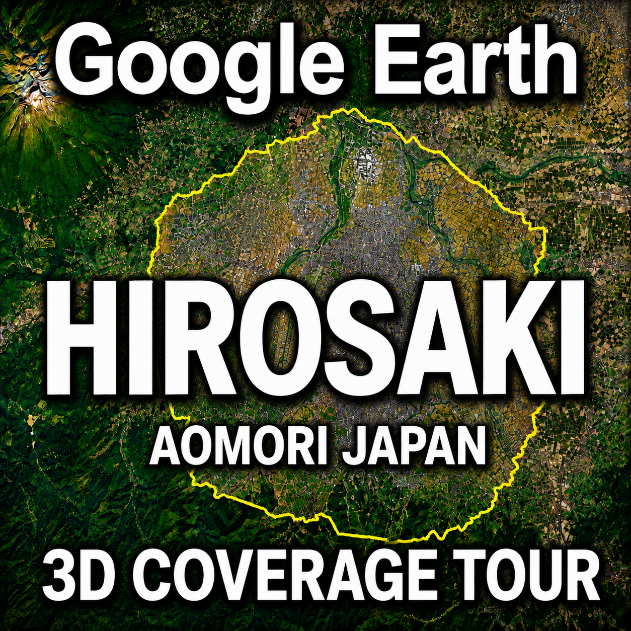
As the first installment in this series, this article introduces the Google Earth 3D coverage of Hirosaki City in Aomori Prefecture, Japan, using a tour video and an overview map.
For regular readers of Global Map Insights
Boundary paths are highly useful for understanding and comparing Google Earth’s 3D coverage between different cities.
However, rather than presenting these paths only as research data, we wanted to find a more enjoyable way to explore them. This idea led to the creation of our 3D Coverage Tour videos.
We hope you enjoy this new way of viewing the coverage data alongside our existing Google Earth research articles.
Google Earth Hirosaki 3D Coverage Tour
This video takes you around the boundary of Google Earth’s photorealistic 3D coverage in Hirosaki City, Japan.
The tour completes a full circuit of the approximately 56.8 km (35.3 mi) boundary in about 75 seconds.
The camera follows the yellow boundary line, providing an aerial view of where Google Earth’s 3D coverage begins and ends.
If the video does not appear, search YouTube for “Global Map Insights.”
What Does the Yellow Line in the Video Represent?
The yellow line shown in the video marks the boundary between Google Earth’s photorealistic 3D coverage and the surrounding standard 2D imagery.
- Yellow line: Boundary of the 3D coverage area
- Right side of the flight path: Photorealistic 3D coverage
- Left side of the flight path: Standard 2D imagery
The tour travels clockwise along the yellow boundary line.
By comparing the right and left sides of the screen, you can see the difference between areas where buildings are represented as three-dimensional models and areas where aerial imagery remains flat.
Overview Map of Hirosaki’s Google Earth 3D Coverage
The images below show the overall extent of the Google Earth 3D coverage identified in Hirosaki.
Hirosaki before the 3D coverage boundary path is displayed

Google Earth 3D coverage in Hirosaki. The yellow line marks the boundary of the photorealistic 3D area.

Google Earth’s 3D coverage does not correspond directly to the administrative boundaries of Hirosaki City.
The entire municipality is not uniformly covered in photorealistic 3D. Instead, the coverage extends across a defined area centered mainly on the urban district.
Viewing the yellow boundary on the overview map makes it easier to understand how far Hirosaki’s 3D coverage extends in each direction.
What Is Photorealistic 3D in Google Earth?
Google Earth’s photorealistic 3D imagery uses three-dimensional models created from aerial photography and other visual data to reproduce buildings and terrain in a realistic form.
In supported cities, users can view building heights, roof shapes, roads, trees and changes in terrain from a variety of angles.
In areas without photorealistic 3D coverage, Google Earth generally displays standard aerial imagery over terrain instead.
Because 3D and 2D areas can exist within the same city, following their boundary provides a clear way to see the extent of Google Earth’s available 3D data.
Why Follow the Boundary of a 3D Coverage Area?
Many Google Earth tour videos focus on famous landmarks, buildings and tourist destinations.
The Global Map Insights 3D Coverage Tour series takes a different approach. Instead of touring the city center, each video focuses on where Google Earth’s photorealistic 3D coverage begins and where it ends.
Following the boundary offers several ways to explore and understand the data:
- Check whether your neighborhood is included in the 3D coverage
- Compare the size and shape of 3D coverage between cities
- Observe the difference between urban and suburban imagery
- Record future expansions or updates to Google Earth’s 3D data
- Explore the outer edges of cities that are often overlooked
In addition to viewing Hirosaki’s geography and cityscape, the tour can be used as a visual record of Google Earth’s 3D coverage at the time of production.
Could Hirosaki’s 3D Coverage Change in the Future?
Google Earth’s aerial imagery and 3D data may be added to or updated over time, depending on the location.
Areas currently displayed in 2D may receive photorealistic 3D coverage in the future, while existing 3D areas may expand into surrounding districts.
For this reason, the video and overview map document the 3D coverage visible in Google Earth at the time of our research.
If we identify a significant change in Hirosaki’s 3D coverage, we plan to update the boundary data and produce a revised tour video.
Explore More Google Earth 3D Coverage
Global Map Insights investigates Google Earth 3D coverage in cities across Japan and around the world.
We will continue publishing tour videos that follow the boundary between photorealistic 3D coverage and standard 2D imagery.
- Google Earth Kushiro 3D Coverage Tour — Coming Soon
- Google Earth 3D Coverage in San Francisco
- Google Earth 3D Coverage in New York City
- Google Earth 3D Coverage in Los Angeles
About Global Map Insights
Global Map Insights independently researches photorealistic 3D coverage, urban change and map-data boundaries in Google Earth and Google Maps.
Our YouTube channel features “3D Coverage Tours” that take viewers around the boundaries of Google Earth’s 3D areas from the air.
Watch the videos to find out whether your city is covered by photorealistic 3D in Google Earth.
If there is a city or region you would like us to investigate or feature in a future tour, please let us know in the YouTube comments.
Watch Global Map Insights on YouTube
Summary
This article introduced the extent of Google Earth’s photorealistic 3D coverage in Hirosaki City through a boundary tour video and overview map.
- The yellow line marks the boundary of Google Earth’s 3D coverage
- The area to the right of the flight path is displayed in photorealistic 3D
- The area to the left is displayed using standard 2D imagery
- The tour travels clockwise around the boundary
- The approximately 56.8 km boundary is covered in about 75 seconds
Google Earth’s 3D coverage has its own shape and extent and does not necessarily follow municipal or administrative boundaries.
Global Map Insights will continue researching and documenting the 3D coverage of cities through videos and maps.
コメント