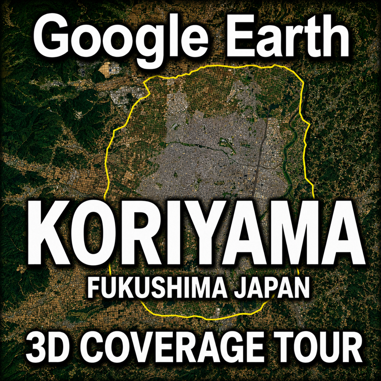
For first-time visitors to Global Map Insights
When you explore a city in Google Earth, some urban areas are displayed using photorealistic 3D imagery, with buildings and terrain reconstructed in three dimensions.
However, simply viewing a city in Google Earth does not always make it clear where the 3D coverage ends and the standard 2D imagery begins.
At Global Map Insights, we independently examine the boundaries between Google Earth’s photorealistic 3D coverage and standard 2D areas. We then create “3D Coverage Tours” that follow these boundaries from the air.
Following Hirosaki in Aomori Prefecture and Kushiro in Hokkaido, the third destination in this series is Koriyama, Fukushima Prefecture, one of the leading cities in Japan’s Tohoku region.
This article introduces the extent of Google Earth’s 3D coverage in Koriyama through a tour video and overview maps.
For returning visitors
The boundary paths of Google Earth’s 3D coverage provide useful reference data for examining and comparing how photorealistic 3D imagery has been implemented in different cities.
This time, we travel around the 3D coverage area of Koriyama, a major transportation and economic center located in central Fukushima Prefecture.
In addition to serving as a geographic reference, the video offers an aerial view of how far Google Earth’s photorealistic 3D coverage extends across this inland Japanese city.
Google Earth Koriyama 3D Coverage Tour
This video follows the boundary of Google Earth’s photorealistic 3D coverage in Koriyama.
The tour completes a circuit of the approximately 48.4-kilometer (30.1-mile) boundary in about 1 minute and 19 seconds.
The camera travels clockwise along the yellow boundary line, showing where Google Earth’s photorealistic 3D coverage transitions into standard 2D imagery.
If the video does not appear, you can watch it directly on YouTube or search for “Global Map Insights” on YouTube.
What Does the Yellow Line in the Video Represent?
The yellow line shown in the video marks the boundary between Google Earth’s photorealistic 3D coverage and the surrounding standard 2D imagery.
- Yellow line: Boundary of the photorealistic 3D coverage area
- Right side of the flight path: Photorealistic 3D coverage
- Left side of the flight path: Standard 2D imagery
- Direction of travel: Clockwise
By comparing the right and left sides of the screen, you can see the difference between areas where buildings are reconstructed in three dimensions and areas where aerial imagery appears mainly as a flat surface.
The mini-map displayed in the video also shows the overall shape of Koriyama’s 3D coverage area and the camera’s current position during the tour.
Overview Map of Koriyama’s Google Earth 3D Coverage
The following images show central Koriyama and the overall extent of its photorealistic 3D coverage in Google Earth.
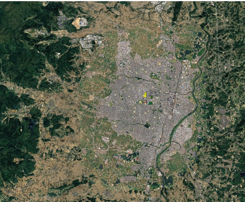
Overview of Koriyama and the surrounding area in Google Earth
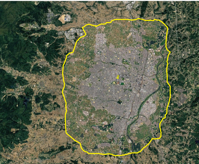
Boundary of Koriyama’s Google Earth 3D coverage, marked by the yellow line
Google Earth’s photorealistic 3D coverage in Koriyama. The yellow line marks the boundary of the 3D area.
Google Earth’s 3D coverage does not correspond to the administrative boundaries of Koriyama City.
The entire municipality has not been converted into photorealistic 3D. Instead, the coverage is concentrated around the built-up urban area, including the area surrounding Koriyama Station.
The overview map shows that the 3D area surrounds much of central Koriyama while also extending north and south through the urbanized corridor.
The administrative area of Koriyama is much larger and includes suburban districts, mountainous areas and territory extending toward Lake Inawashiro.
Therefore, the yellow line in these images does not represent the official city boundary. It marks the limit of the photorealistic 3D data currently visible in Google Earth.
What Is Included in Koriyama’s 3D Coverage Area?
Koriyama’s photorealistic 3D coverage is centered on Koriyama Station and the central urban area. It also extends into surrounding residential, commercial, industrial and distribution districts.
From an aerial perspective, the coverage reveals several features that characterize Koriyama’s urban structure, including the dense city center around the station, residential districts extending north and south, and the landscape near the Abukuma River.
Koriyama is an important railway junction served by the Tohoku Shinkansen, Tohoku Main Line, Ban-etsu West Line and Ban-etsu East Line.
Around Koriyama Station, the concentration of buildings creates a distinctly urban photorealistic 3D landscape.
Koriyama Station can be seen on the right side of the video shortly after the 50-second mark.
Beyond the center are low-rise residential neighborhoods, farmland and hilly terrain. As the tour moves toward the outskirts, changes in land use become increasingly visible.
Unlike a conventional map designed to show tourist attractions or administrative boundaries, this tour visualizes the actual extent of Google Earth’s 3D dataset. The result is a distinctive boundary that surrounds Koriyama’s urban area.
What Koriyama’s 3D Boundary Reveals About an Inland City
Unlike Kushiro, which faces the Pacific Ocean, Koriyama is located inland in Fukushima Prefecture.
As a result, Koriyama’s 3D coverage boundary does not pass over the sea. Instead, it travels through and around urban districts, residential neighborhoods, farmland, rivers and hilly terrain.
The area inside the yellow line contains a large concentration of developed land, while agricultural and mountainous landscapes become more prominent outside the boundary.
The overview map also shows how Koriyama’s urban area has developed across relatively flat land surrounded by hills and mountains.
One of the most interesting features of this tour is the opportunity to compare the physical shape of the city with the extent of Google Earth’s photorealistic 3D dataset.
What Is Photorealistic 3D in Google Earth?
Google Earth’s photorealistic 3D display uses three-dimensional models created from aerial imagery and other geographic data. Image textures are applied to these models to reproduce buildings and terrain in a form that resembles the real-world landscape.
In supported cities, users can view the height and shape of buildings, rooftops, roads, trees, rivers, railway facilities and variations in terrain from different angles.
Areas without photorealistic 3D coverage are generally displayed using standard aerial imagery and terrain data.
Because 3D and 2D areas can exist within the same city, following the boundary makes it possible to see exactly how far Google Earth’s photorealistic dataset extends.
Why Follow the Boundary of a 3D Coverage Area?
Many Google Earth tour videos focus on famous landmarks and tourist attractions.
The Global Map Insights 3D Coverage Tour series takes a different approach. Instead of traveling from one attraction to another, each tour examines where Google Earth’s photorealistic 3D coverage begins and where it ends.
Following the boundary offers several ways to explore and analyze a city:
- Check whether your neighborhood is included in the 3D coverage area
- Compare the shapes and sizes of 3D coverage areas in different cities
- Observe differences between central districts and suburban areas
- Document future expansions and updates to Google Earth’s 3D data
- Explore urban fringes that are rarely featured in conventional city tours
- Examine 3D data boundaries near rivers, farmland and hilly terrain
The Koriyama tour can therefore be used not only to view the city but also as a visual reference for understanding the extent of Google Earth’s geographic data.
Comparing the 3D Coverage of Hirosaki, Kushiro and Koriyama
The first tour in the series followed Hirosaki’s approximately 56.8-kilometer boundary in about 75 seconds.
The second tour traveled around Kushiro’s approximately 51.3-kilometer boundary in about 76 seconds.
The Koriyama tour follows an approximately 48.4-kilometer boundary and takes about 79 seconds to complete.
- Hirosaki: Approximately 56.8 km — about 75 seconds
- Kushiro: Approximately 51.3 km — about 76 seconds
- Koriyama: Approximately 48.4 km — about 79 seconds
Among these three cities, Koriyama has the shortest measured boundary. It is approximately 8.4 kilometers shorter than Hirosaki’s and approximately 2.9 kilometers shorter than Kushiro’s.
However, boundary length alone cannot be used to determine the total size or characteristics of a 3D coverage area. The distance is also affected by the overall shape of the area and the number of smaller curves and indentations along its perimeter.
Hirosaki has an inland urban area surrounded by the landscape of the Tsugaru Plain. Kushiro’s coverage includes port facilities and part of the coastal landscape. Koriyama’s coverage forms a relatively compact inland area centered on a major transportation hub.
Watching the three tours together reveals how differently Google Earth’s photorealistic 3D coverage has been implemented in each city.
Koriyama’s Google Earth 3D Coverage May Change in the Future
Google Earth’s aerial imagery and 3D data are periodically added or updated, although the timing and extent of these changes vary by region.
Areas currently displayed in 2D may receive photorealistic 3D coverage in the future, and existing 3D areas may expand into surrounding districts.
This video and the accompanying maps document the extent of Koriyama’s Google Earth 3D coverage at the time of production.
If a significant change is identified in the future, we plan to update the boundary data and produce a new tour video.
Recording the current boundary also creates a useful reference for determining how and in which direction the coverage expands when future updates occur.
Explore More Google Earth 3D Coverage Tours
Global Map Insights examines Google Earth’s photorealistic 3D coverage in cities across Japan and around the world.
More videos following the boundaries between photorealistic 3D coverage and standard 2D imagery will be added to the series.
- Google Earth 3D Coverage Tour | City Video Library
- Google Earth Hirosaki 3D Coverage Tour
- Google Earth Kushiro 3D Coverage Tour
- San Francisco Google Earth 3D Coverage Map
- Google Earth New York 3D Coverage Evolution
- Google Earth Los Angeles 3D Coverage Map
About Global Map Insights
Global Map Insights independently examines photorealistic 3D coverage in Google Earth and Google Maps, changes in urban landscapes, and the boundaries of geographic datasets.
Our YouTube channel features “3D Coverage Tours” that travel around the extent of Google Earth’s photorealistic 3D areas.
Unlike conventional sightseeing videos, these tours do not focus primarily on famous attractions. Instead, they explore the actual area in which each city is represented in photorealistic 3D.
Watch the videos to find out whether your city or neighborhood is included in Google Earth’s 3D coverage.
If there is a city you would like us to investigate or feature in a future tour, please let us know in the YouTube comments.
Watch Global Map Insights on YouTube
Summary
This article introduced the extent of Google Earth’s photorealistic 3D coverage in Koriyama through a boundary tour video and overview maps.
- The yellow line marks the boundary of Google Earth’s photorealistic 3D coverage
- The right side of the flight path is the photorealistic 3D area
- The left side of the flight path is the standard 2D area
- The tour follows the boundary clockwise
- The approximately 48.4-kilometer boundary is completed in about 1 minute and 19 seconds
- The main 3D coverage area includes Koriyama Station and the surrounding urban districts
Google Earth’s photorealistic 3D coverage does not follow municipal or administrative boundaries. Instead, it has its own distinctive extent based on the availability of 3D geographic data.
In Koriyama, the coverage includes the city center that developed around its major transportation connections, together with surrounding residential districts, rivers, farmland and hilly terrain.
Comparing Hirosaki, Kushiro and Koriyama also demonstrates how the shape of a 3D coverage area can differ between inland cities and coastal cities.
Global Map Insights will continue examining and documenting Google Earth’s photorealistic 3D coverage through maps and aerial boundary tours.
コメント