Google Earth上で3D表示となっている日本全国のエリアを可視化しました。
引きの画像なので大雑把に見えますが、それぞれの3Dエリアのラインには個性があります。
各エリアの詳細や考察は今後加筆していきたいと思います。
また、各都道府県の3D都市リストでも触れていきます。
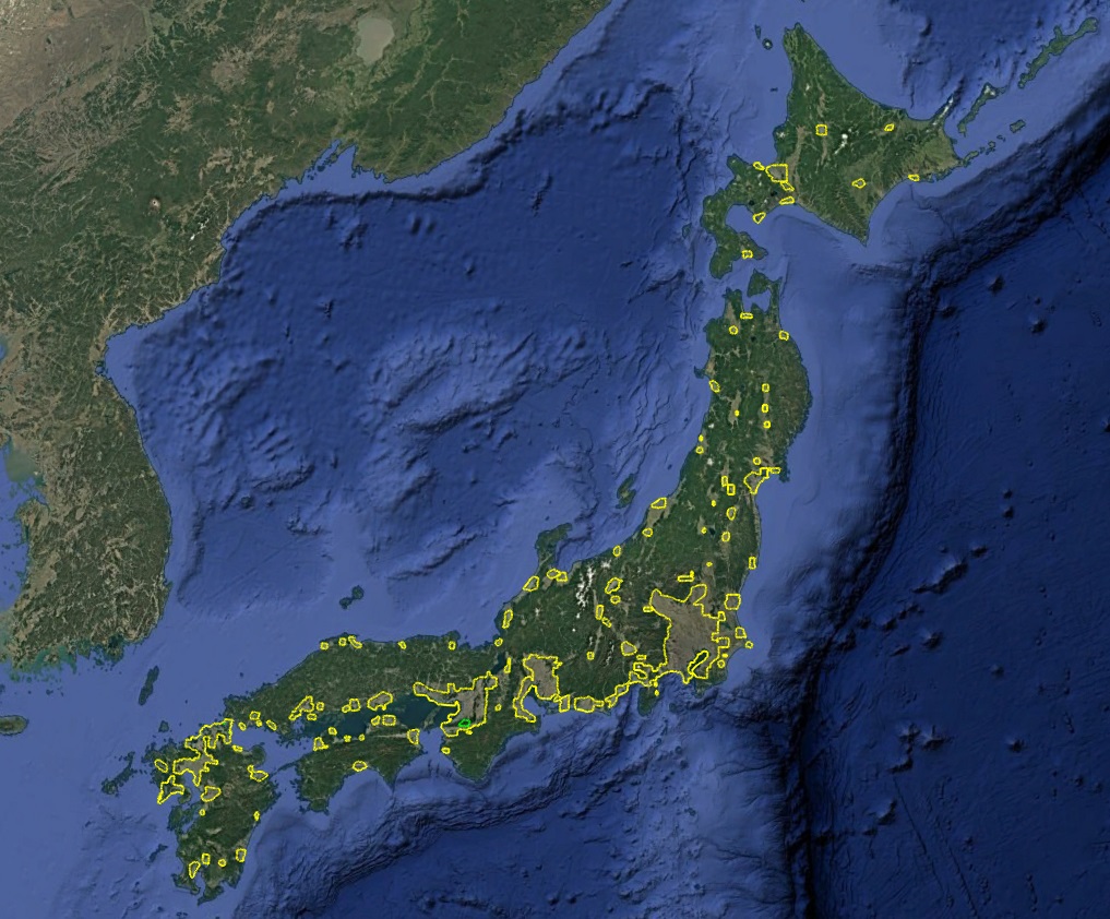
Google Earth 日本全国の3Dエリア
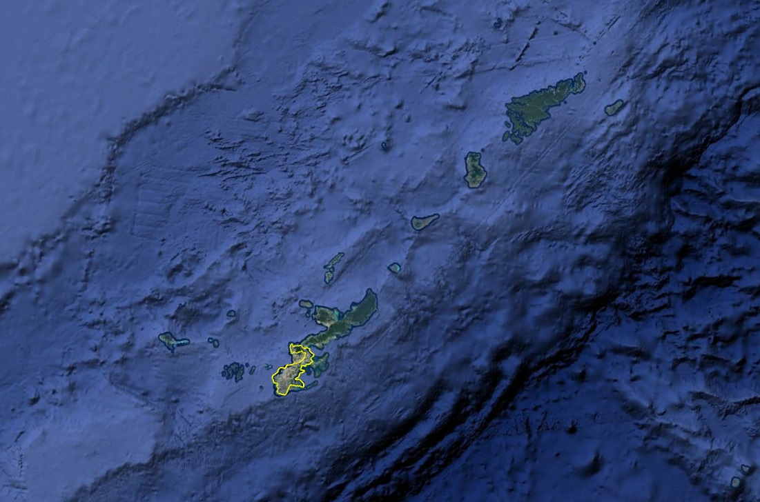
Google Earth 沖縄本島の3Dエリア
Explore the latest visualization of Japan’s 3D coverage on Google Earth! View the newly published map images showing nationwide areas with 3D support and get a snapshot of what to expect in upcoming detailed posts.
コメント