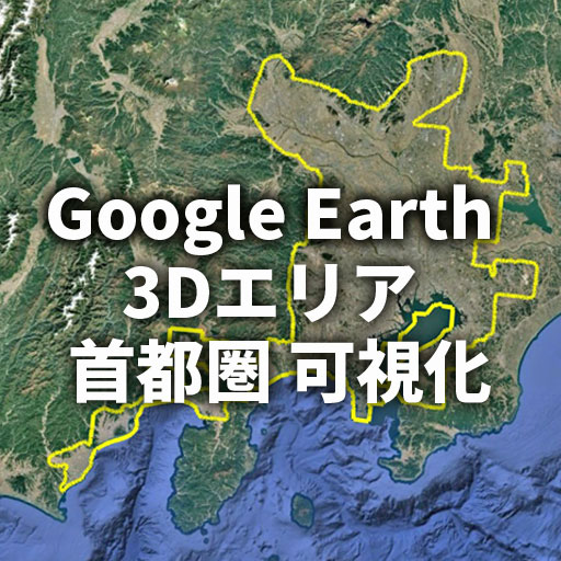
【Google Earth】首都圏3D表示エリア1,390kmの全容を可視化(2026年2月)
Google Earth 3D Coverage of Greater Tokyo – 1,390 km Visualization (Feb 2026)
都道府県別3Dエリアリスト(関東方面)は現在制作中です。
その公開に先立ち、首都圏3Dエリアの全体像を可視化した資料を先行公開します。
今後公開予定の詳細リストとあわせてお楽しみください。
Google Earth 3D Coverage of Greater Tokyo – 1,390 km Visualization (Feb 2026)
As of February 2026, the Greater Tokyo 3D coverage on Google Earth forms a massive 1,390 km continuous polygon stretching from Chiba to Shizuoka. This article visualizes its full extent and analyzes its geographic structure.
Google Earth 首都圏 3Dエリア
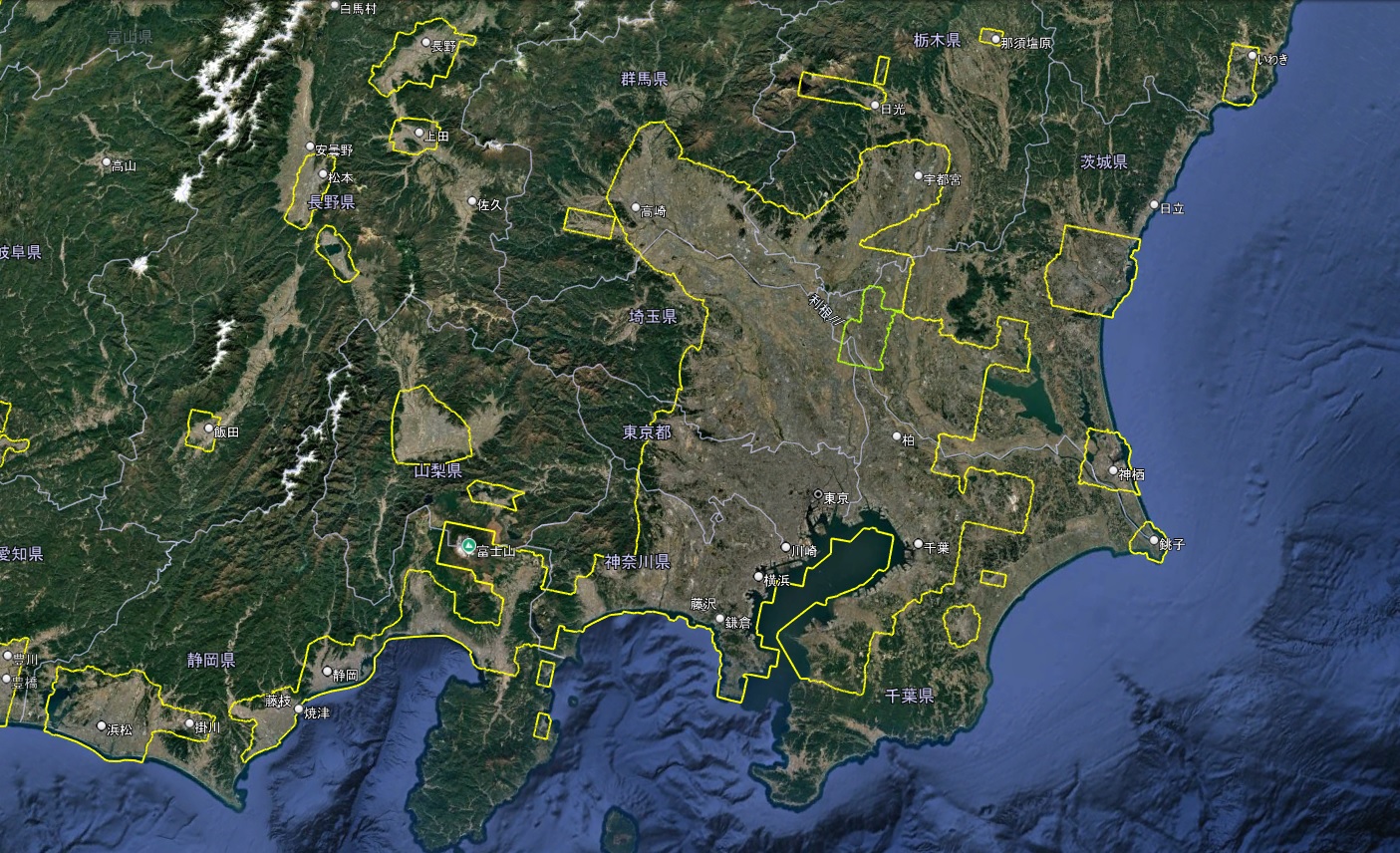
Google Earth 首都圏 3D表示エリア(緑の線は2D)
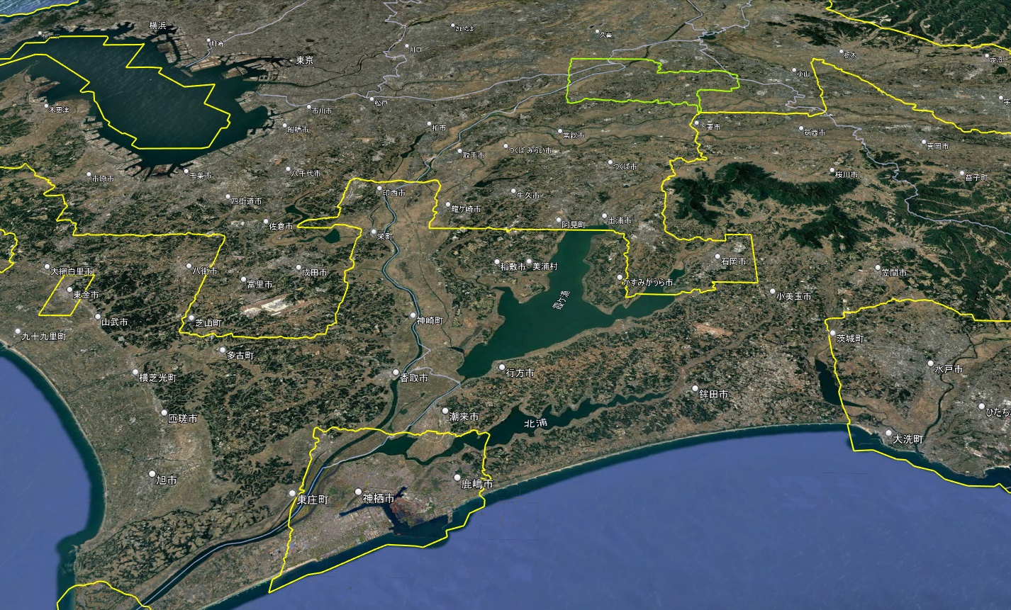
首都圏3Dエリアの中に2Dエリアの飛び地が存在します。
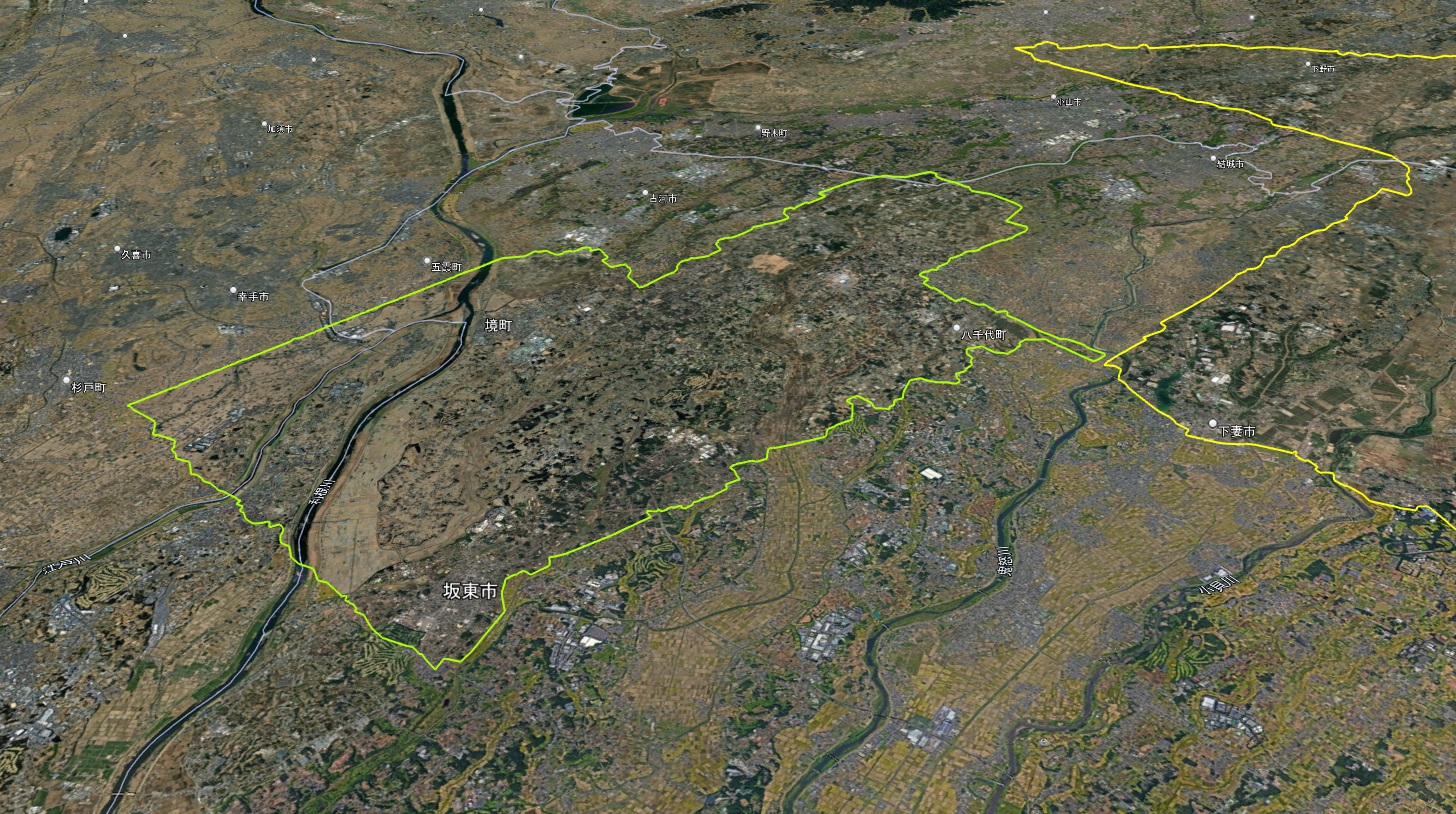
Google Earth 首都圏 3D表示エリアの中の2Dエリア(緑色の線)
位置は栃木県・茨城県・埼玉県の3県をまたぎ、そのほとんどが茨城県内です。
2Dエリアのラインの距離は89kmにおよびます。
千葉方面から3D表示エリアを見る
首都圏3Dエリアは内陸のラインと海沿いのラインで構成されています。
千葉県はスタートとなりその地点は千葉県富津市の上総湊港付近です。
ここから北関東に向かい、神奈川県と富士山を経て静岡県の牧之原市で海に出て海岸線を辿り富津市に戻ります。
Google Earth 首都圏 3D表示エリア(緑の線は2D)
Google Earth 首都圏 3D表示エリア(緑の線は2D)
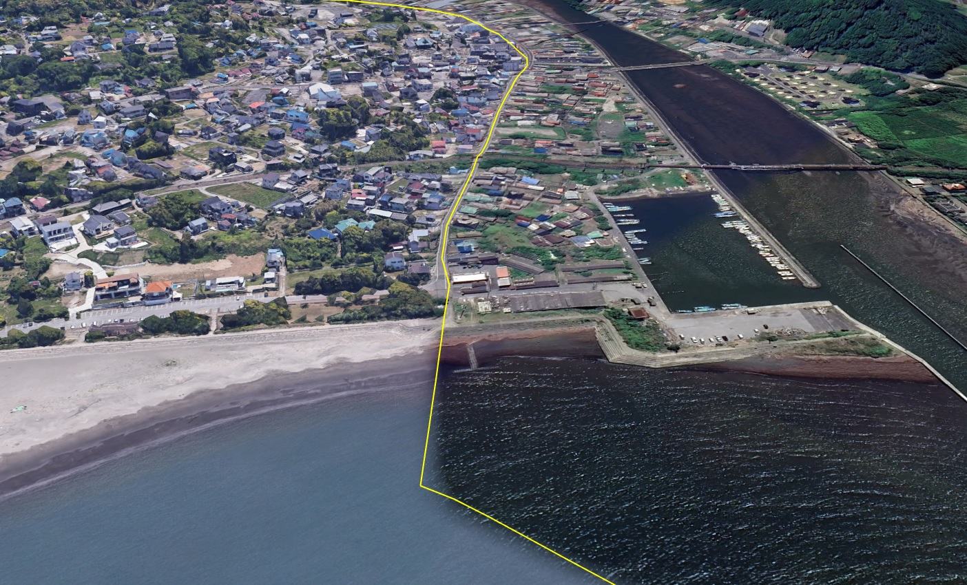
Google Earth 千葉県富津市 上総湊港付近
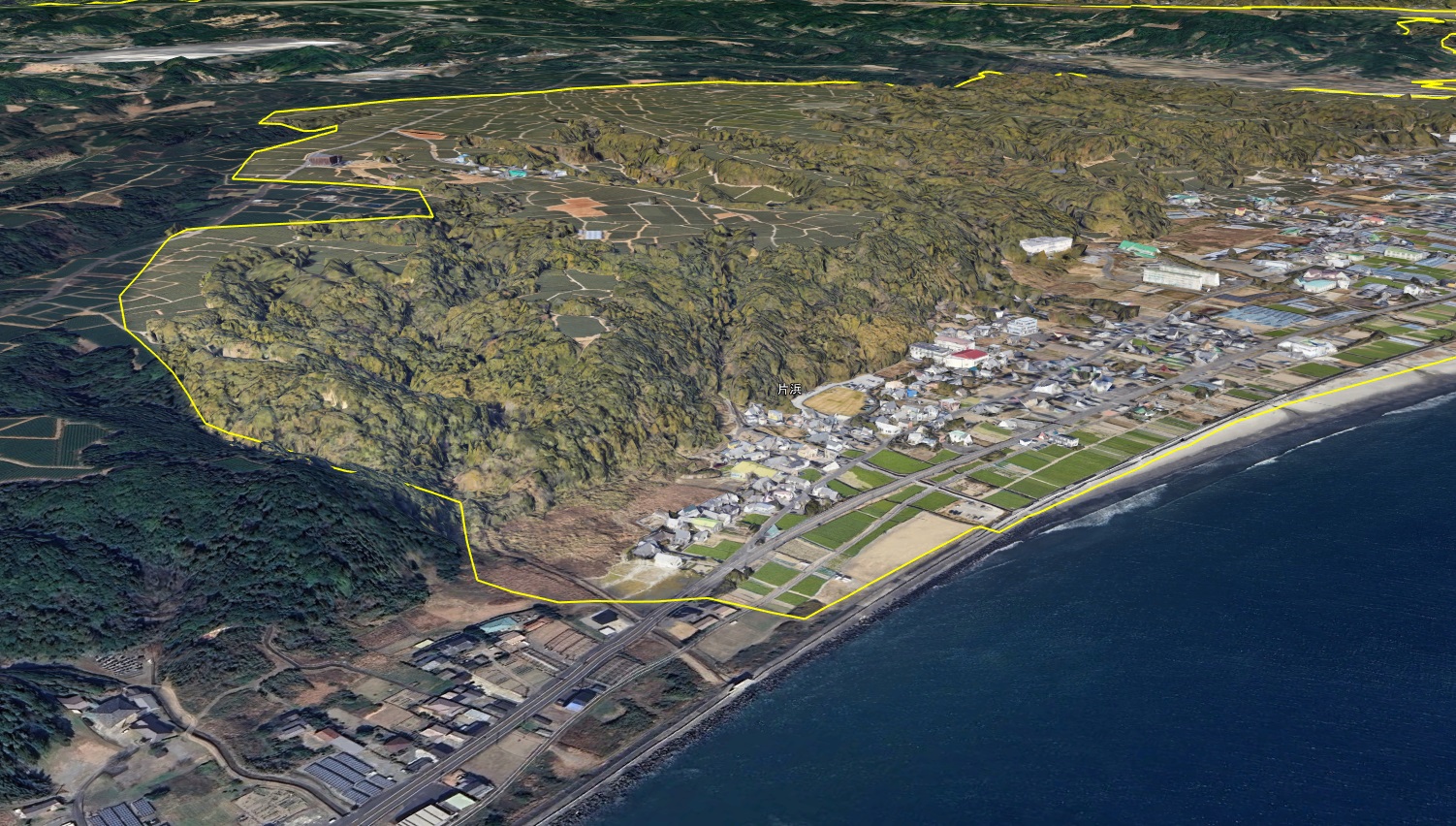
Google Earth 静岡県 牧之原市 方浜付近
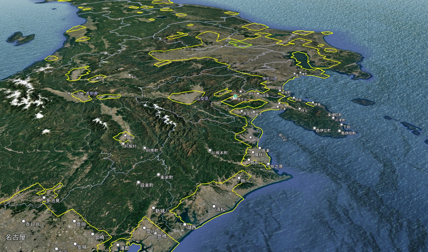
静岡方面から首都圏3D表示エリアを見る
首都圏3Dエリアの起点は、千葉県富津市にあります。静岡県の牧之原市の方浜区ふれあい広場西詰付近で3Dエリアがら海に出ます。
Google Earth 首都圏 3D表示エリア(緑の線は2D)
首都圏3Dエリアのラインは、すでに首都圏を越え、静岡県の牧之原市にまで及んでいることが確認できます。これは、静岡市以西の島田市・藤枝市・焼津市・牧之原市が2Dから3D表示へと変化したことが主な要因です。
一方で、袋井市・磐田市・浜松市の3Dエリアとは、現時点ではまだ分離しています。
両エリアの間には山間部と菊川市が存在しており、ここが3D化されれば、一気にエリアは西へ拡張する可能性があります。
もし連結が実現すれば、「首都圏3Dエリア」という名称では実態を表しきれず、「首都圏東海エリア」と呼ぶべき段階に入るかもしれません。
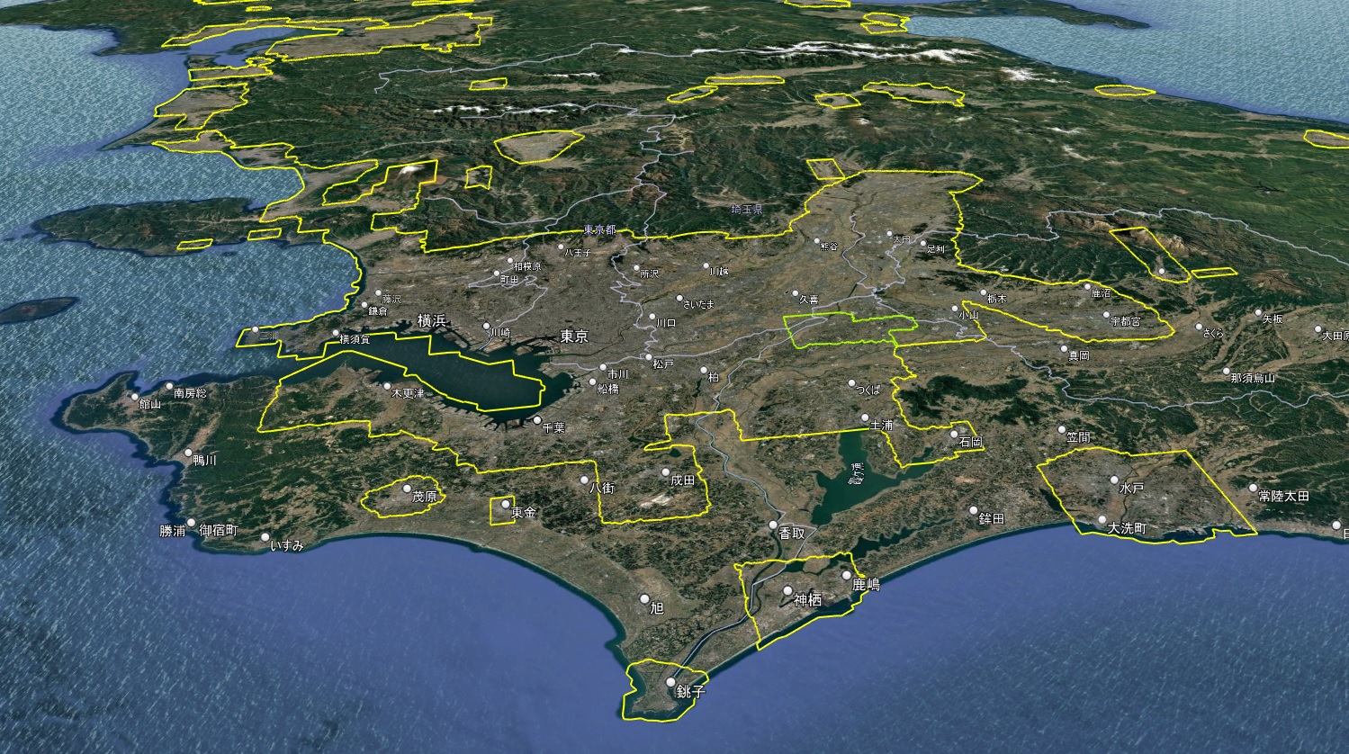
茨城県方面から3D表示エリアを見る
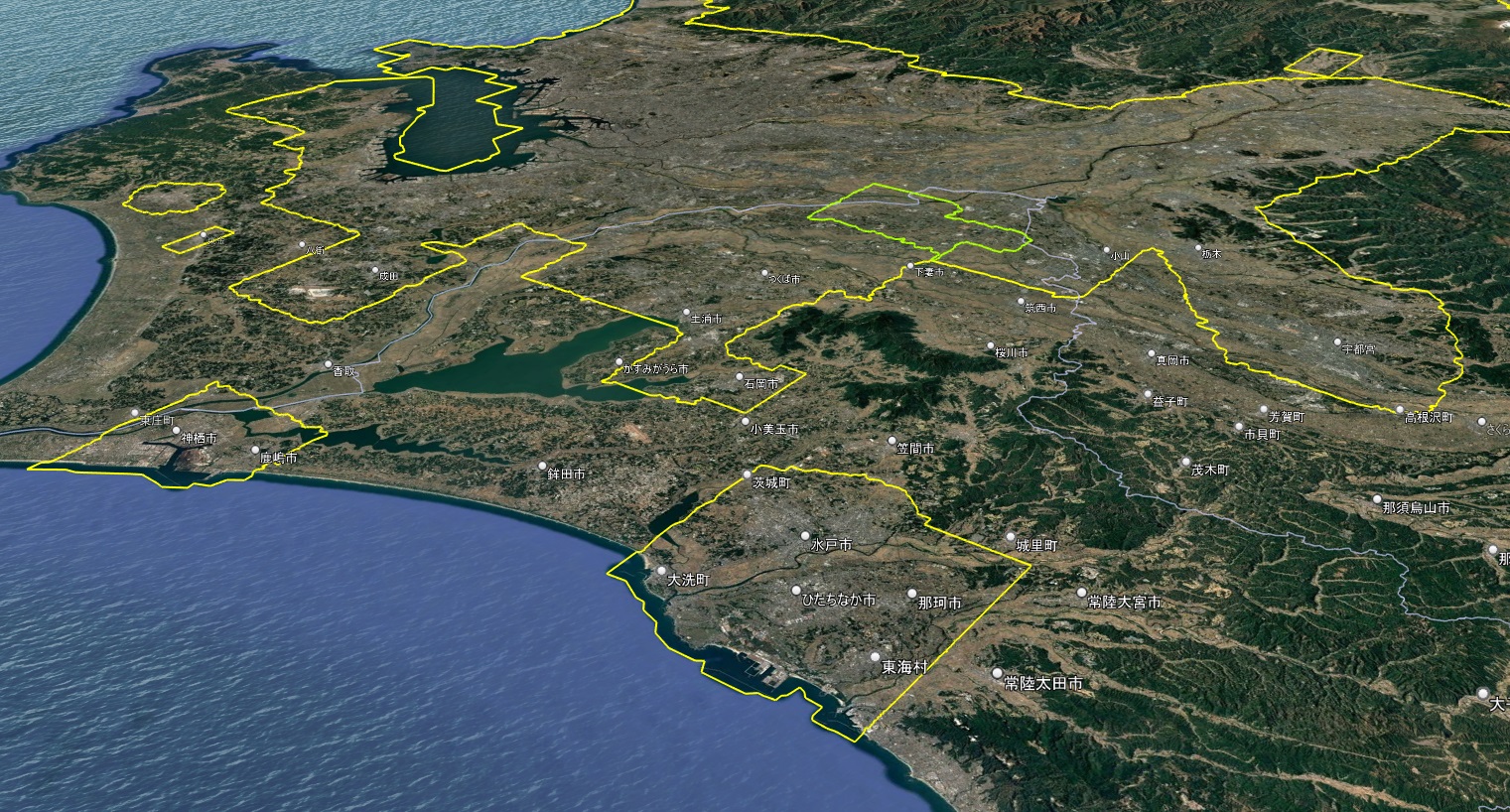
Google Earth 首都圏 3D表示エリア(緑の線は2D)
水戸市の3Dエリアは、現在のところ首都圏3Dエリアから独立しています。
しかし、宇都宮市もかつては分離状態にありながら、周辺都市の3D化によって最終的に首都圏エリアと連結しました。
今後、笠間市や小美玉市などの3D化が進めば、水戸市エリアが連結する可能性も十分に考えられます。
群馬県方面から3D表示エリアを見る
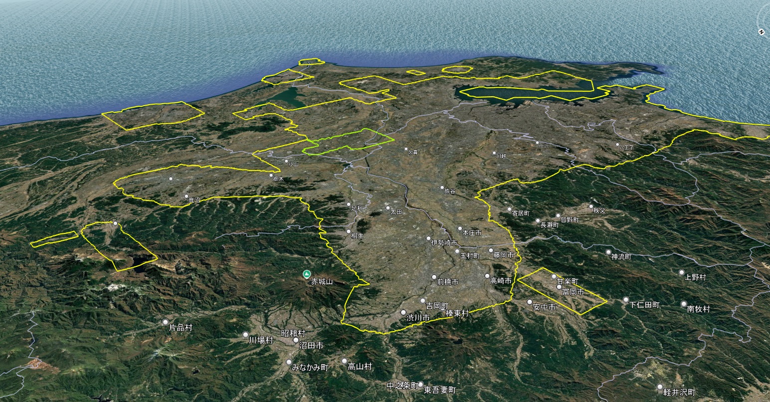
Google Earth 首都圏 3D表示エリア(緑の線は2D)
首都圏3Dエリアは群馬県も含みます。高崎市、前橋市はもちろん、渋川市にまで3Dエリアが及んでいます。
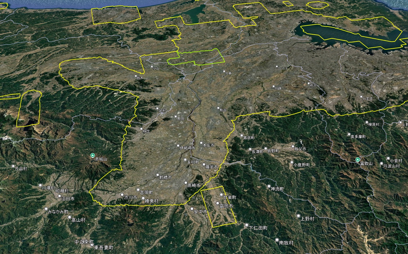
Google Earth 首都圏 3D表示エリア(緑の線は2D)
富岡市の3Dエリアは、首都圏3Dエリアとかなり近接しています。
これほど距離が近いにもかかわらず、なぜ分離しているのでしょうか。
これは、既存の富岡市エリアとは別に、藤岡市の3D表示化などによって首都圏エリアが拡張し、結果的に両者が接近したためです。
首都圏の3D表示エリアのスタートとゴールを結ぶ総距離は?
広域を誇る首都圏3Dエリアのスタート地点とゴール地点は、いずれも千葉県富津市・上総湊港付近にあります。
●スタート:千葉県富津市 上総湊港付近(0km)
↓
内陸部(千葉県・茨城県・栃木県・群馬県・東京都・神奈川県・富士山・箱根・静岡県)
↓
静岡県牧之原市片浜「方浜区ふれあい広場」西詰付近で陸地が終端(約1,000km)
↓
そこから沿岸部を通過
↓
●ゴール:千葉県富津市 上総湊港付近(約1,390km)
■総距離:約1,390km
・陸地:約1,000km
・沿岸部:約390km
この距離は、東京駅から福岡市をで結んだ直線にあてはめると韓国・済州島の南方海域に達するほどのスケールです。
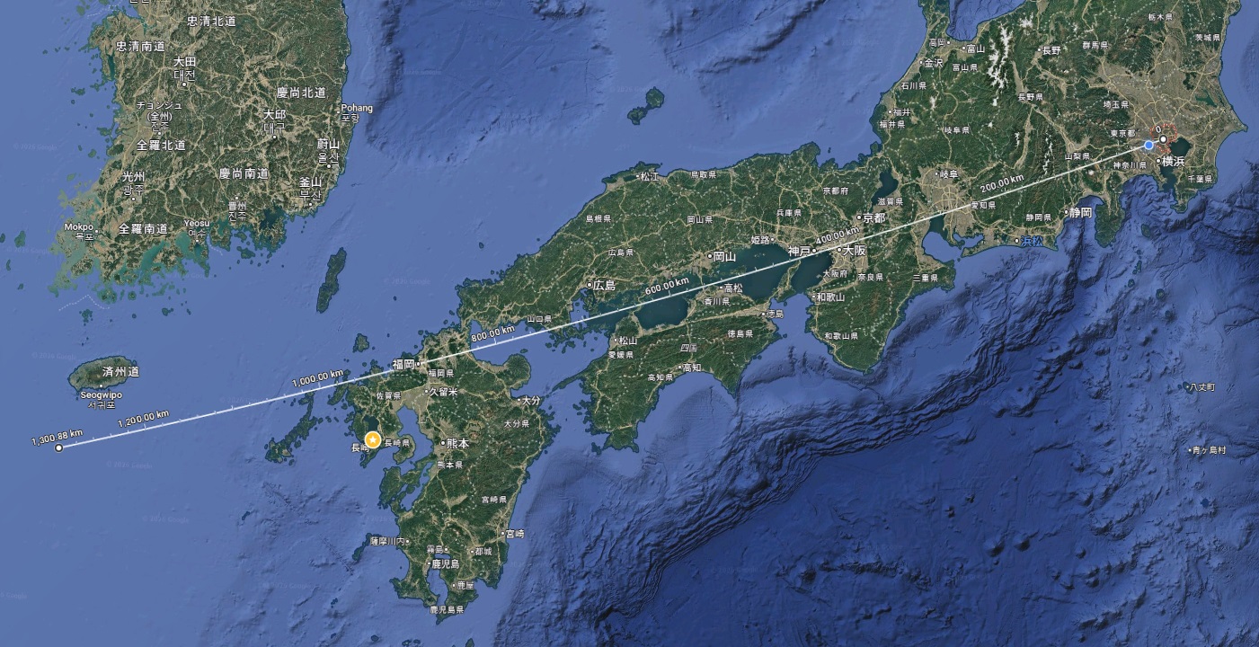
Google Earth 首都圏 3D表示エリアの総距離
首都圏3Dエリアは、もはや“首都圏”という名称の枠を超え、関東から東海に及ぶ巨大な環状ポリゴンへと進化しているといえるでしょう。
では次の都道府県別リストの公開と3Dエリアの公開まで今しばらくお待ちください。
Overview of the 3D Coverage
The Greater Tokyo 3D coverage now spans a vast area across the Kanto region and into central Japan.
What began as a metropolitan cluster has evolved into a large-scale continuous polygon covering inland and coastal zones.
The structure is no longer limited to Tokyo but extends far beyond the traditional metropolitan boundary.
Starting Point: Futtsu, Chiba
The starting point of the 3D coverage loop is located near Kazusa-Minato Port in Futtsu City, Chiba Prefecture.
From this coastal origin, the polygon expands inland through multiple prefectures before reaching its westernmost land boundary.
Western Boundary: Makinohara, Shizuoka
The western land boundary is identified near the Nishizume area of Katahama, Makinohara City, Shizuoka Prefecture.
At this point, the 3D polygon leaves the inland area and transitions toward the coastal stretch, marking the furthest westward expansion on land.
Total Distance Analysis (1,390 km)
The full loop distance of the Greater Tokyo 3D coverage measures approximately 1,390 kilometers.
Of this, around 1,000 km runs across inland terrain, while roughly 390 km follows coastal zones.
This scale is comparable to the straight-line distance from Tokyo to Fukuoka.
Future Expansion Potential
The remaining gaps between regional 3D clusters suggest strong expansion potential.
If additional municipalities between eastern Shizuoka and western Kanagawa become 3D-enabled, the polygon could further consolidate and expand westward.
Continued updates may significantly reshape the geographic definition of the “Greater Tokyo” 3D area.
コメント