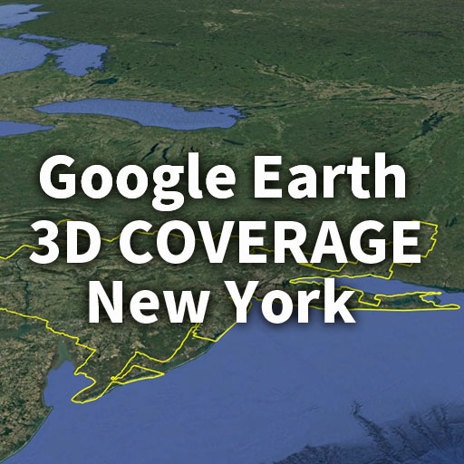
How far does Google Earth’s 3D coverage really extend in New York City?
Back in 2017, Google Earth Blog reported that the 3D area around New York covered approximately 19,500 km²—one of the largest in the world at the time.
But what about today?
In this article, we go beyond past reports and examine the current state of 3D coverage. Using Google Earth Pro, we manually traced the boundaries of the 3D imagery to visualize exactly which areas are truly rendered in 3D.
We also provide the actual boundary data (KML file) used in this analysis, allowing you to explore the coverage directly in Google Earth.
Section 1:Current 3D Coverage Area in New York (Manually Traced Results)
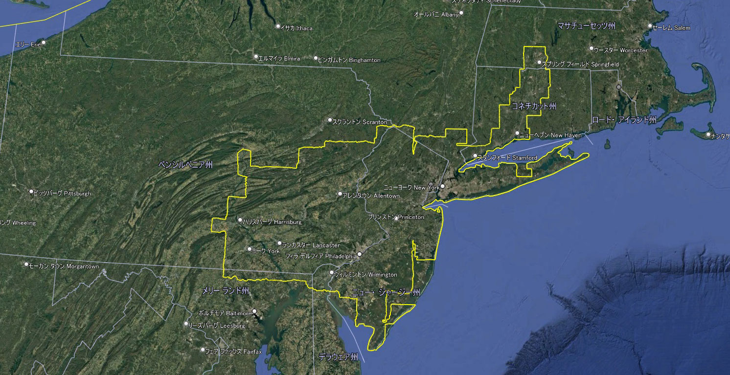
Google Earth 3D View of New York City
By manually tracing the boundaries of 3D imagery in Google Earth Pro, we found that the total perimeter of New York’s 3D coverage reaches approximately 2,516 km.
This is not limited to New York City alone.
The 3D coverage now extends far beyond the city, spanning multiple states including New Jersey, Pennsylvania, and Connecticut.
Instead of isolated urban zones, the data reveals a vast, continuous 3D region covering the greater metropolitan area.
This suggests that Google’s 3D mapping has evolved from city-based coverage to a much broader regional scale.
Section 2: Comparison with Materials Up to 2017
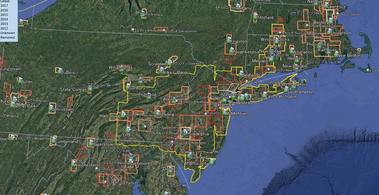
Evolution of Google Earth 3D Coverage in New York (2017 vs Today)
Yellow line: Current coverage
Other lines: Data from the Google Earth Blog
As of 2017, 3D coverage was fragmented into patch-like areas, each corresponding to individual cities.
However, today these areas have been seamlessly connected, forming a single, large unified region.
This transformation suggests a significant shift in both the display standards and the overall development strategy behind Google Earth.
These historical datasets can therefore be considered a valuable archive, documenting the continuous evolution of Google Earth over time.
Estimated 3D Coverage Area of New York (Scale Analysis & Growth)
Based on the traced perimeter of approximately 2,516 km, we also attempted to estimate the total area of New York’s 3D coverage.
To do this, we first calculated a theoretical value by assuming a circular shape, then applied corrections to better reflect the actual irregular geometry of the region.
Under a simple circular assumption, the area would reach roughly 500,000 km². However, this is clearly an overestimate, as the real 3D coverage contains gaps and follows a highly complex shape.
After applying a more realistic correction based on metropolitan-scale patterns, the current 3D coverage around New York is estimated to be between 120,000 and 220,000 km².
For comparison, the coverage was reported to be approximately 19,500 km² in 2017.
This suggests that the 3D coverage has expanded several times over, potentially reaching a scale far beyond what was previously recognized.
Download the New York 3D Coverage KML File (Explore It Yourself)
The boundary data of New York’s 3D coverage used in this analysis is available as a downloadable KML file.
By loading it into Google Earth, you can explore the exact 3D coverage area yourself—just as analyzed in this article.
This allows you to visually verify which areas are fully rendered in 3D and where the gaps remain.
▶ Download the KML File (Free)
The Expanding Future of Google Earth’s 3D Coverage
Beyond the New York region explored in this article, major metropolitan areas such as Los Angeles and San Francisco have also shown significant expansion in 3D coverage.
We will take a closer look at these regions in dedicated articles, analyzing how their 3D boundaries compare in scale and structure.
In addition, early comparisons with Japan’s 3D mapping reveal notable differences in coverage patterns and density—offering a fascinating contrast that we will explore in future posts.
As Google continues to update its mapping technology, one question remains:
How far will Google Earth’s 3D coverage expand next?
If you prefer reading in Japanese, you can view the original detailed article here:Japanese version here
コメント