 Google Earth 3Dエリア
 【Google Earth】関東2D表示エリアが縮小-関宿町が3Dに-
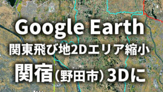
Google Earthで関宿周辺の2D表示エリア縮小を確認しました。現在の関宿城博物館周辺と過去の河川位置を比較しながら、関宿城や城下町、旧江戸川(逆川)の歴史を上空から考察します。河川の流路変化によって変わった景観にも注目です。
Google Earth 3Dエリア  Google Earth 3Dエリア
  Google Earth(JP)
  Google Earth(JP)
  Google Earth 3Dエリア
  Google Earth 3Dエリア
  Google Earth 3Dエリア
  Google Earth 3Dエリア
  Google Earth(JP)